
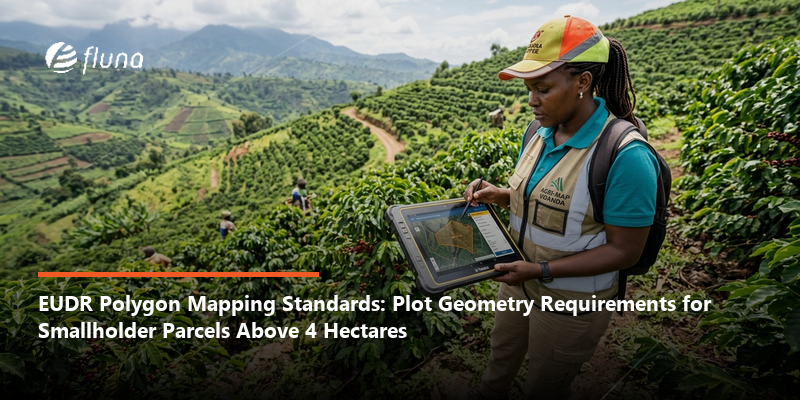
EUDR Polygon Mapping Standards: Plot Geometry Requirements for Smallholder Parcels Above 4 Hectares
By Sandra Nansbuga
EUDR Polygon Mapping Standards: Plot Geometry Requirements for Smallholder Parcels Above 4 Hectares
Under the EU Deforestation Regulation, plots of four hectares or less can be mapped with a single GPS coordinate point, while plots larger than four hectares require full polygon boundary mapping using latitude and longitude to at least six decimal places. A 2026 simplification allows some operators to submit a postal address instead of coordinates, but that option is limited to micro and small primary operators based in low-risk countries; since Uganda is classified as standard risk, Ugandan farm groups do not qualify for this shortcut and must still capture actual geolocation data regardless of farm size.
The point-versus-polygon threshold. Article 9 of Regulation (EU) 2023/1115 requires the geolocation of every plot of land where a covered commodity was produced. For plots of four hectares or less, a single latitude/longitude point suffices; for plots larger than four hectares, a polygon describing the plot's full perimeter is required, according to multiple compliance guides referencing the regulation's Article 2 and Article 9 text, including Coolset. Coordinates must carry at least six decimal places in both cases, and the EU's Information System accepts geolocation data only in GeoJSON digital format, according to TraceX and Farmerline.
One polygon, one plot. Under Article 2, a "plot of land" is defined as a single continuous area within one property, uniform enough to be assessed as a single deforestation-risk unit. The European Commission's own FAQ confirms that a single polygon cannot be used to cover several separate plots of land, per Coolset's summary of that guidance. This has a direct operational consequence for farm groups: a cooperative combining coffee from many smallholder members cannot submit one polygon representing the group's total sourcing area; each member's individual plot must be separately geolocated, as either a point or a polygon depending on its own size.
The postal-address shortcut does not apply to Uganda. A December 2025 amendment to the EUDR (Regulation (EU) 2025/2650) introduced a simplified one-time declaration for Micro or Small Primary Operators, allowing them to submit a postal address instead of geolocation coordinates, provided the address clearly corresponds to the plot's location. This option is explicitly restricted to primary operators established in low-risk countries, according to Chambers and Partners' summary of the May 2026 EU Commission simplification package. Uganda is classified as standard risk under the EU's country benchmarking system, which means this postal-address alternative is not available to Ugandan smallholders or farm groups; actual point or polygon coordinates are required regardless of operator size.
Who bears responsibility for accuracy. Even when a smallholder or farm group supplies the underlying coordinates, the EU-based operator placing the product on the market is legally responsible for the accuracy of that geolocation data, according to TraceX's compliance guidance. This means an EU importer sourcing from Uganda cannot simply pass on unverified farmer-collected coordinates; validation of the data against the plot's actual location is the importer's obligation, which in practice often requires capacity-building support extended to the smallholder groups collecting the data in the first place.
What this means for Uganda-linked buyers and farm groups
| Attribute | Plots ≤4 hectares | Plots >4 hectares |
|---|---|---|
| Required geolocation format | Single lat/long point, 6+ decimal places | Full perimeter polygon, GeoJSON format |
| Field data collection effort | One GPS reading per plot | Multiple boundary points walked or mapped per plot |
| Postal-address alternative available to Uganda | No (Uganda is standard risk, not low risk) | No |
Because most Ugandan smallholder coffee farms fall well under the four-hectare threshold, typically in the range of 0.5 to 2.5 hectares according to USDA production data, the majority of individual member plots in a Ugandan farm group will require only point-based mapping rather than the more labor-intensive polygon boundary work. This is genuinely useful for cooperative logistics planning, but it does not reduce the number of mapping exercises required, since the one-polygon-per-plot rule means each smallholder's land still needs its own individually captured coordinate, even if many members are aggregated under a single cooperative or exporter relationship. Buyers working with Ugandan farm groups should budget field mapping time and cost per individual member plot, not per cooperative, and should specifically flag any consolidated estate-style blocks over four hectares for full polygon mapping rather than assuming a point coordinate will suffice. Given that missing or malformed geolocation data is commonly cited as the leading cause of Due Diligence Statement rejection, and that liability for accuracy sits with the EU-based buyer rather than the Ugandan supplier, investing in validated mapping now, ahead of the 30 December 2026 deadline, reduces the risk of shipments being held at the point of import.
FAQ
Q: Can Ugandan smallholders use a postal address instead of GPS coordinates under the EUDR's 2026 simplification?
A: No. The postal-address alternative introduced under Regulation (EU) 2025/2650 is limited to micro and small primary operators established in low-risk countries. Uganda is classified as standard risk under the EU's country benchmarking system, so this simplification does not apply to Ugandan farm groups.
Q: What plot size determines whether point or polygon mapping is required under the EUDR?
A: Plots of four hectares or less can be submitted as a single geolocation point; plots larger than four hectares require a full polygon describing the plot's perimeter, both using coordinates with at least six decimal places.
Q: Can a Ugandan cooperative submit one polygon covering all its members' combined coffee plots?
A: No. Under the European Commission's own FAQ guidance, a single polygon cannot cover multiple separate plots of land. Each smallholder member's individual plot must be geolocated separately, whether as a point or a polygon depending on its own size.
Sources: European Commission - Green Forum | Coolset | TraceX | Farmerline | Chambers and Partners